Orkaner igen, några
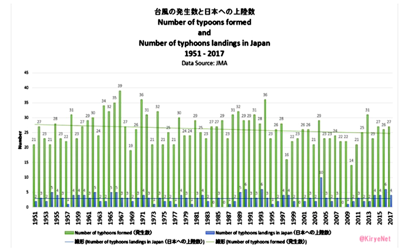
diagram. Först ut är Japan.
Stormar som bildas och stormar som når
land.
Sedan läser vi
västra om Stilla havet norr om ekvatorn när det gäller orkaner.
The western North Pacific (WNP) is the most active ocean basin for
tropical cyclone (TC) activity, with very significant societal and
economic impacts. Over 1997–2014, the number of WNP TCs has abruptly
decreased (~18%). We examine the relative roles of sea surface
temperature (SST) changes and anthropogenic forcing in this decrease of
WNP TCs. This change of WNP TCs is driven by an intensification of the
vertical wind shear in thesoutheastern/eastern WNP which is mainly tied
to SST warming in the North Atlantic, while the SST anomalies associated
with the negative Pacific Decadal Oscillation phase and the
anthropogenic forcing only play secondary roles. The present study
suggests a crucial role of the North Atlantic SST in causing the
observed decadal change in WNP TC frequency.
http://onlinelibrary.wiley.com/doi/10.1002/2017GL076397/abstract
I världen främsta
stormhål kring Filippinerna har orkanfrekvensen minskat
med 18%. Vad beror det på? De vill knyta det till
havets yttemperatur i Atlanten. Kan det stämma?
Hur är det då med
orkaner i Atlanten? Följande skriver en känd forskare Klotzbach.
https://journals.ametsoc.org/doi/pdf/10.1175/BAMS-D-17-0184.1

Det finns inga betydande trender säger han. Hur ser då det ut med frekvens och intensitet?
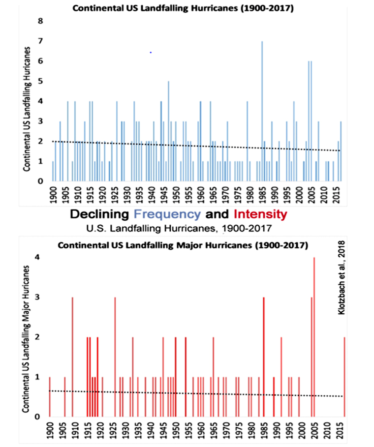
Svagt fallande
trender. Ingen ökning som alla talar om och som jag får hålla på och
tjafsa med mina elever om.
En sammanfattande artikel http://notrickszone.com/skeptic-papers-2018-3/